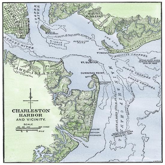
US Civil War, 1861-1865: Map of the Port of Charleston, South Carolina, Showing the Exact Location
Choose size
Finished Size: 16" x 16"

Just the Print

Black Frame

White Frame

Brown Frame

Stretched Canvas
$79

Canvas Black
$151

Wood Mount

Laminate
Just the Print
$32
Chelsea Black
$148
Chelsea White
$148
Chelsea Espresso
$148

Stretched Canvas
$79

Canvas Black
$151
Wood Mount
$101
Laminate
$57

Just the Print
$32

Chelsea Black
$148

Chelsea White
$148

Chelsea Espresso
$148

Stretched Canvas
$79

Canvas Black
$151

Wood Mount
$101

Laminate
$57

Just the Print
$38

Chelsea Black
$275

Chelsea White
$275

Chelsea Espresso
$275

Stretched Canvas
$89

Canvas Black
$161

Wood Mount
$128

Laminate
$63

Just the Print
$49

Gramercy Black
$286

Gramercy White
$286

Gramercy Espresso
$286

Stretched Canvas
$169

Canvas Black
$241

Wood Mount
$151

Laminate
$74
see more frame options
$32
Arrives by Sat, Aug 9 to 66952

$32
16" x 16" - Giclee Print
16" x 16" - Giclee Print