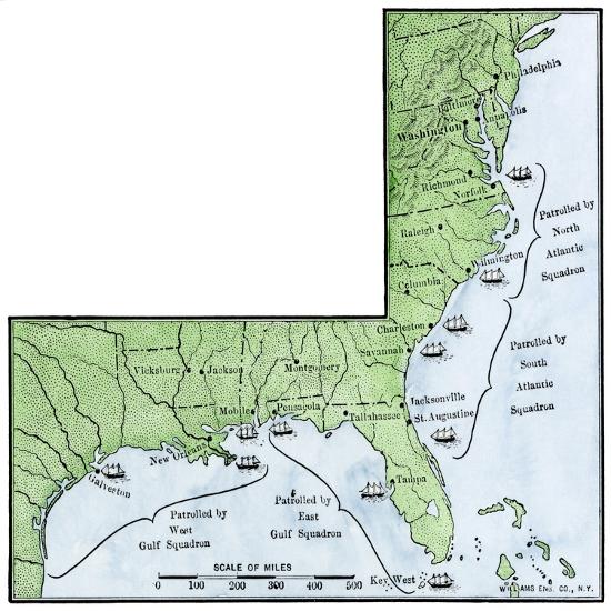
US Civil War, 1861-1865: Geographic Map Showing the Blockade of the Coastal Coasts of the Confedera
Choose size
Finished Size: 16" x 16"

Just the Print

Black Frame

White Frame

Brown Frame

Stretched Canvas
$79

Canvas Black
$151

Wood Mount

Laminate

Just the Print
$38
Chelsea Black
$154
Chelsea White
$154
Chelsea Espresso
$154

Stretched Canvas
$79

Canvas Black
$151
Wood Mount
$107
Laminate
$63

Just the Print
$38

Chelsea Black
$154

Chelsea White
$154

Chelsea Espresso
$154

Stretched Canvas
$79

Canvas Black
$151

Wood Mount
$107

Laminate
$63

Just the Print
$60

Chelsea Black
$297

Chelsea White
$297

Chelsea Espresso
$297

Stretched Canvas
$89

Canvas Black
$161

Wood Mount
$150

Laminate
$85

Just the Print
$104

Gramercy Black
$341

Gramercy White
$341

Gramercy Espresso
$341

Stretched Canvas
$169

Canvas Black
$241

Wood Mount
$206

Laminate
$129
see more frame options
$38
Arrives by Fri, May 30 to 66952

$38
16" x 16" - Premium Giclee Print
16" x 16" - Premium Giclee Print